


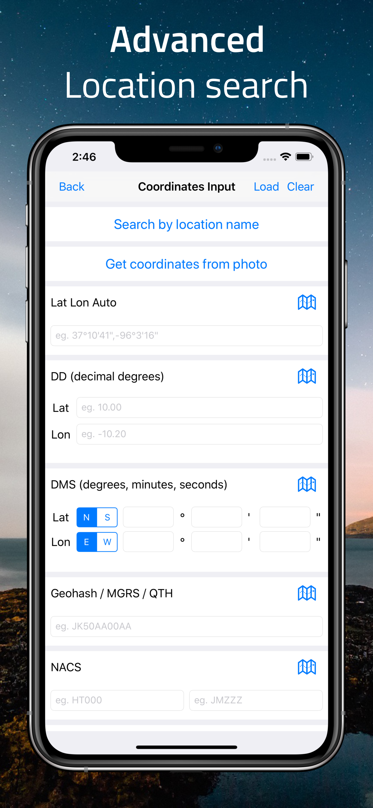
Coordinates
Coordinates is a powerful, user-friendly app for working with geographic locations — perfect for travelers, surveyors, and GIS professionals.
Easily find your location at the center of the screen where the grey lines intersect. View coordinates instantly in multiple formats, including Latitude/Longitude, UTM, MGRS, Georef, Plus Codes, and more.
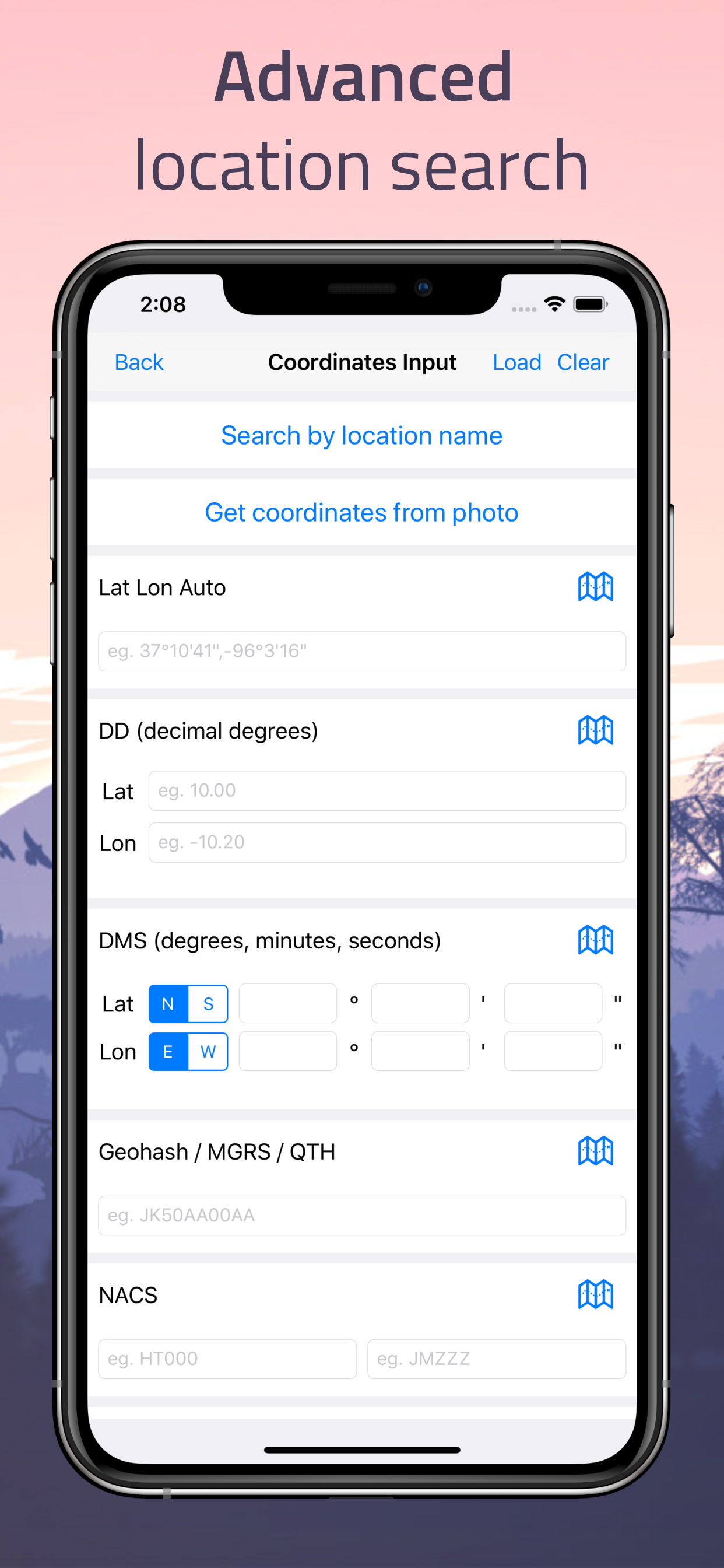
Search for locations by name, city, or country. Tap the map, enter coordinates manually, or use GPS for precise placement.
Advanced features include real-time tracking, bearing and distance measurement, EPSG datum conversion, and support for importing/exporting GPX, KML, and GeoJSON.
Whether you're in the field or planning from home, Coordinates gives you full control over your location data — all from a clean, modern interface.

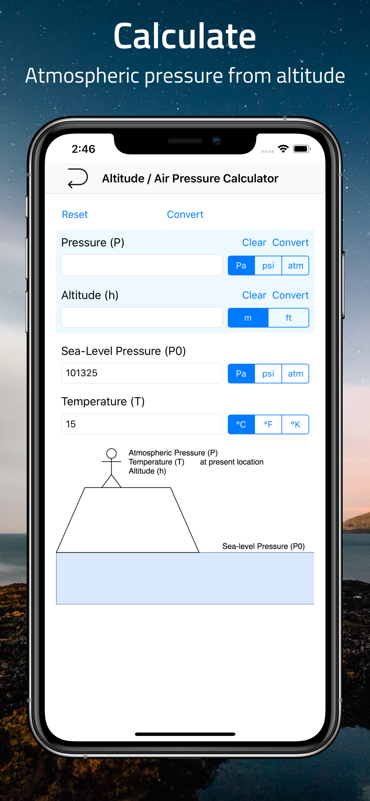
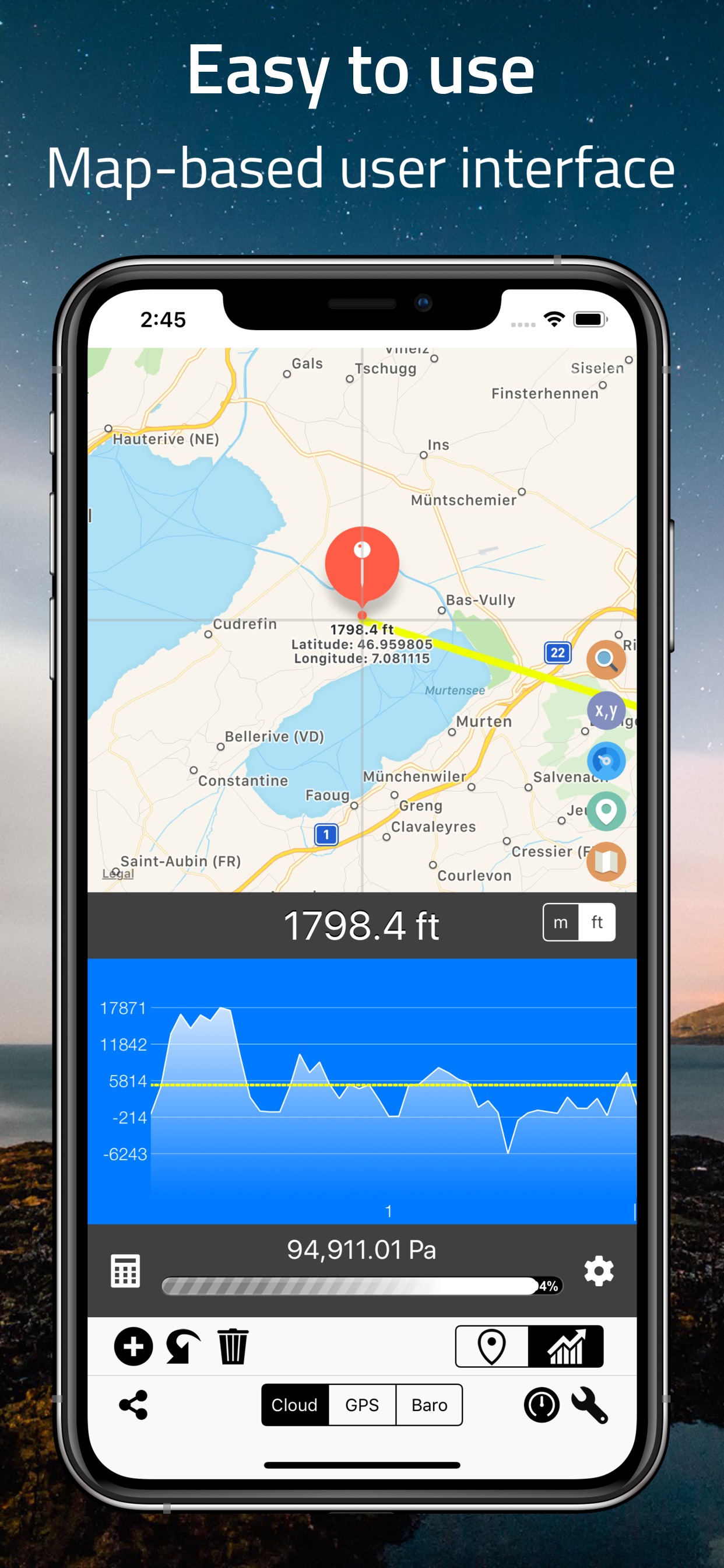

Elevation
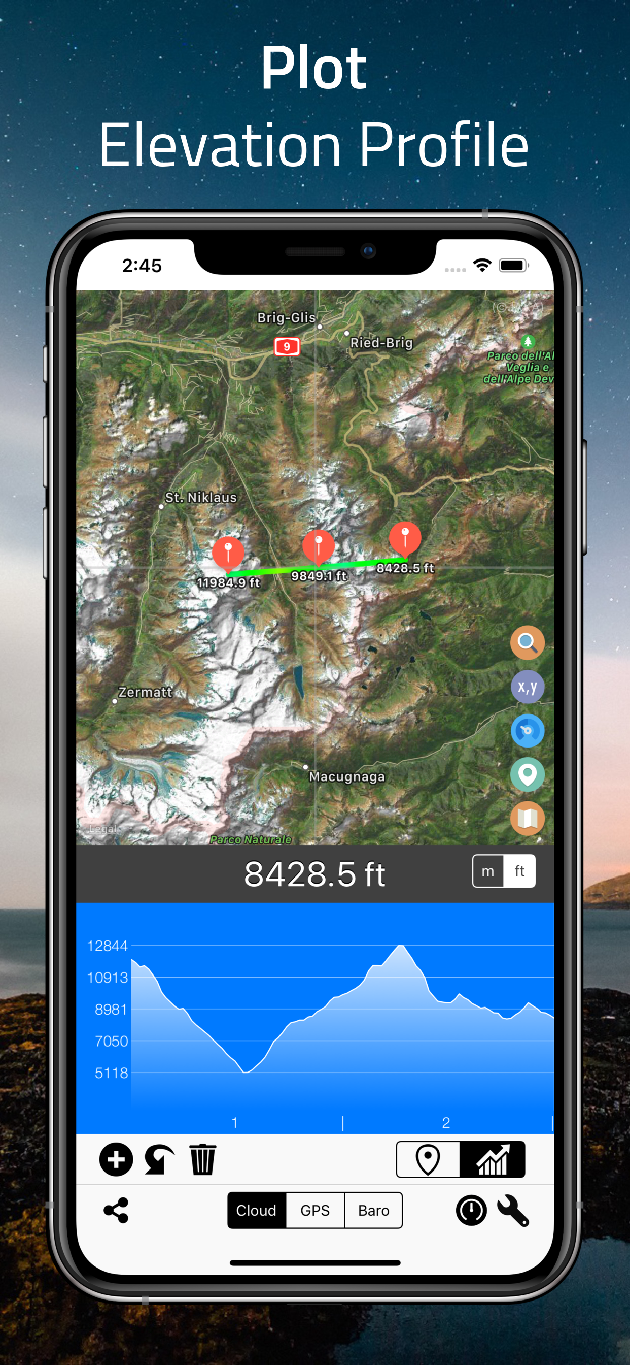
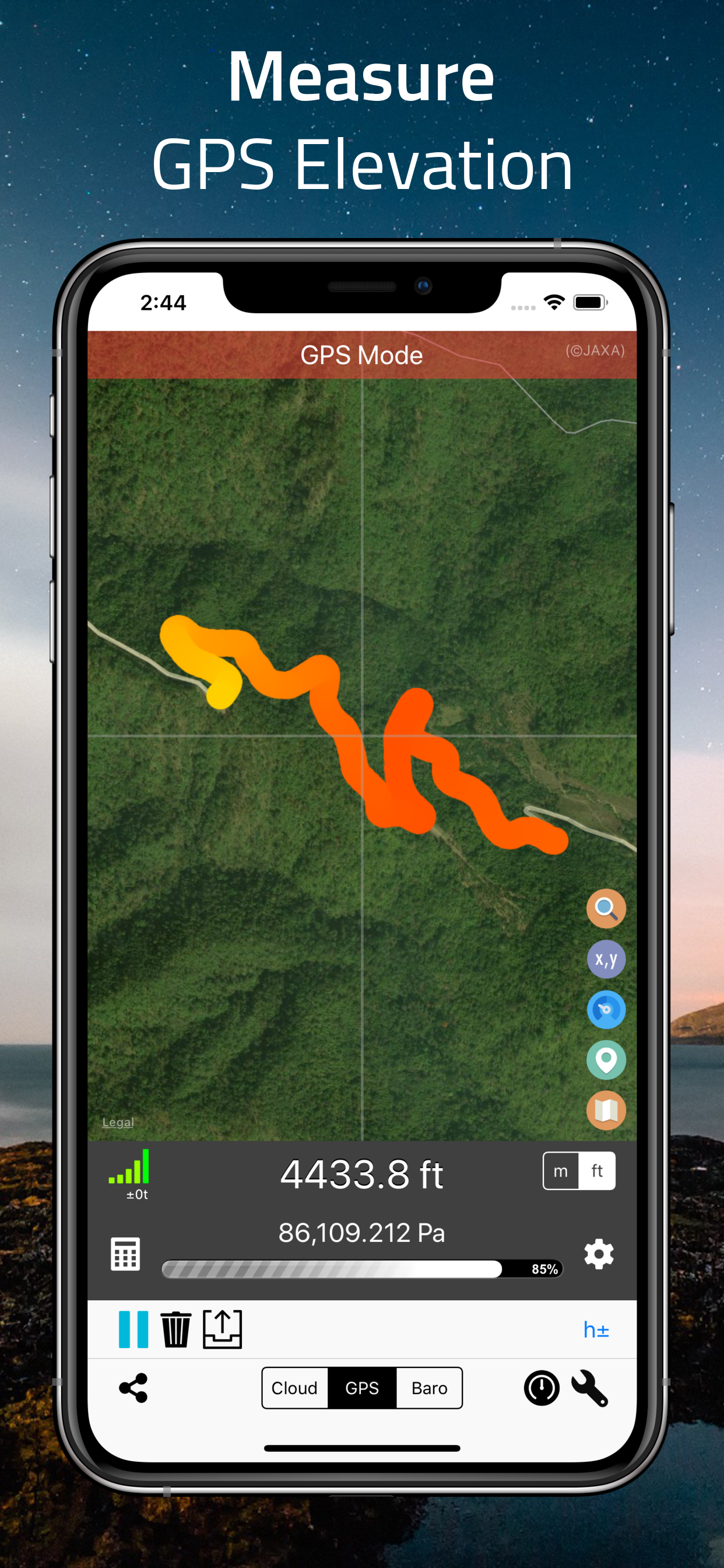
Easily find your current elevation, altitude, or height above sea level.
This tool lets you check the elevation of any point on Earth. Move the map, search for a location, or tap anywhere to get precise elevation data.
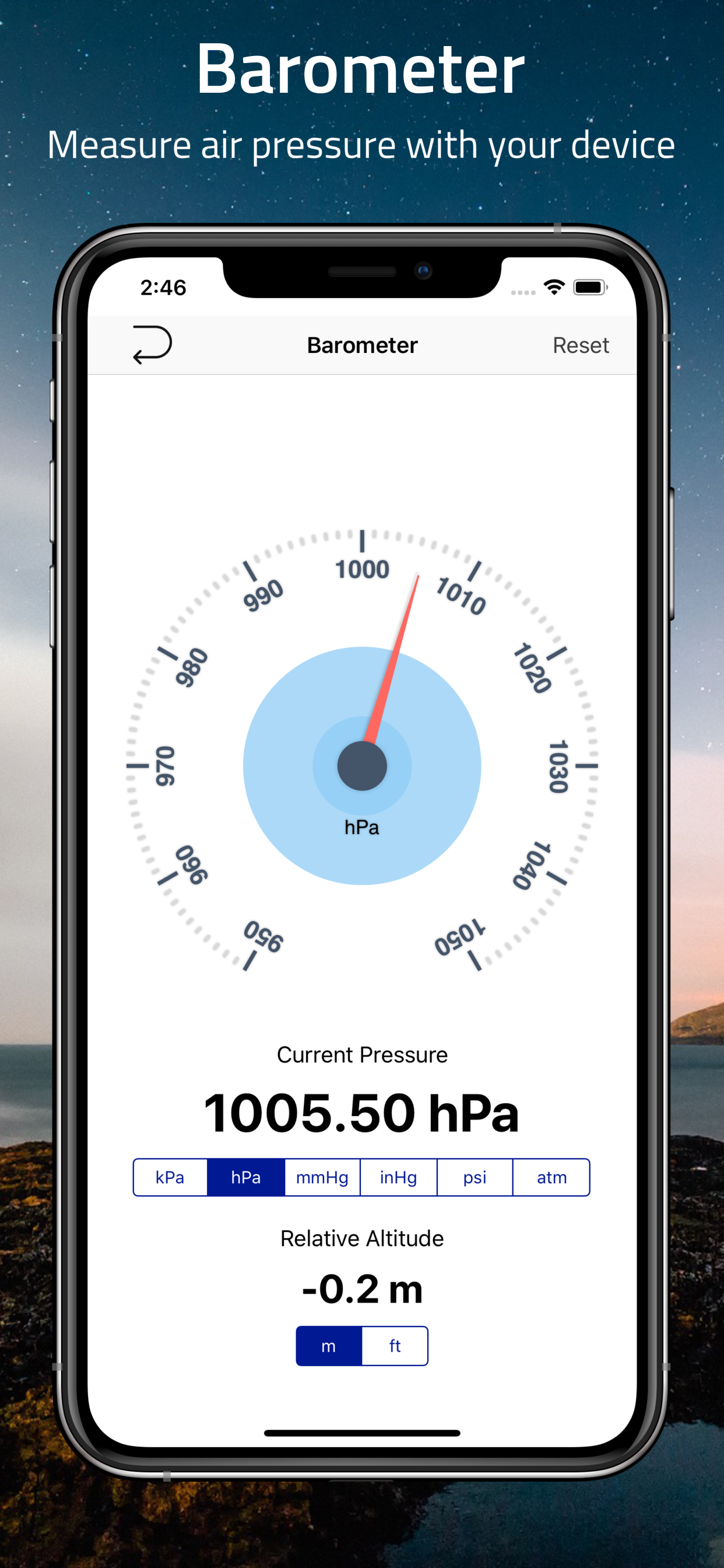
Get elevation from GPS, your device’s barometer, or cloud-based sources. You can even use the app as a standalone barometer — and more.


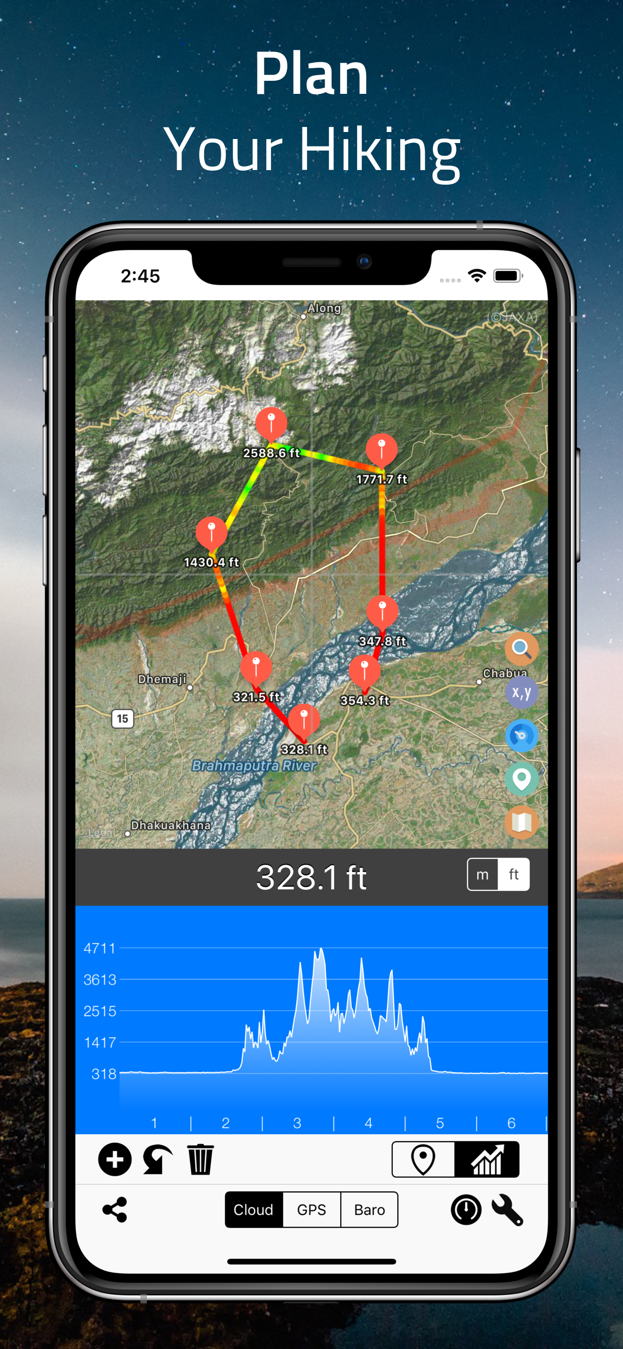
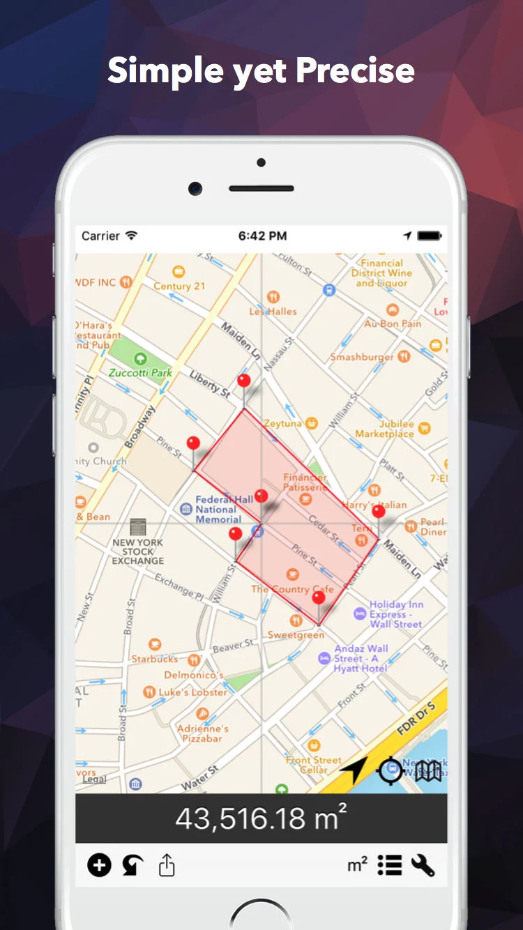
Distance
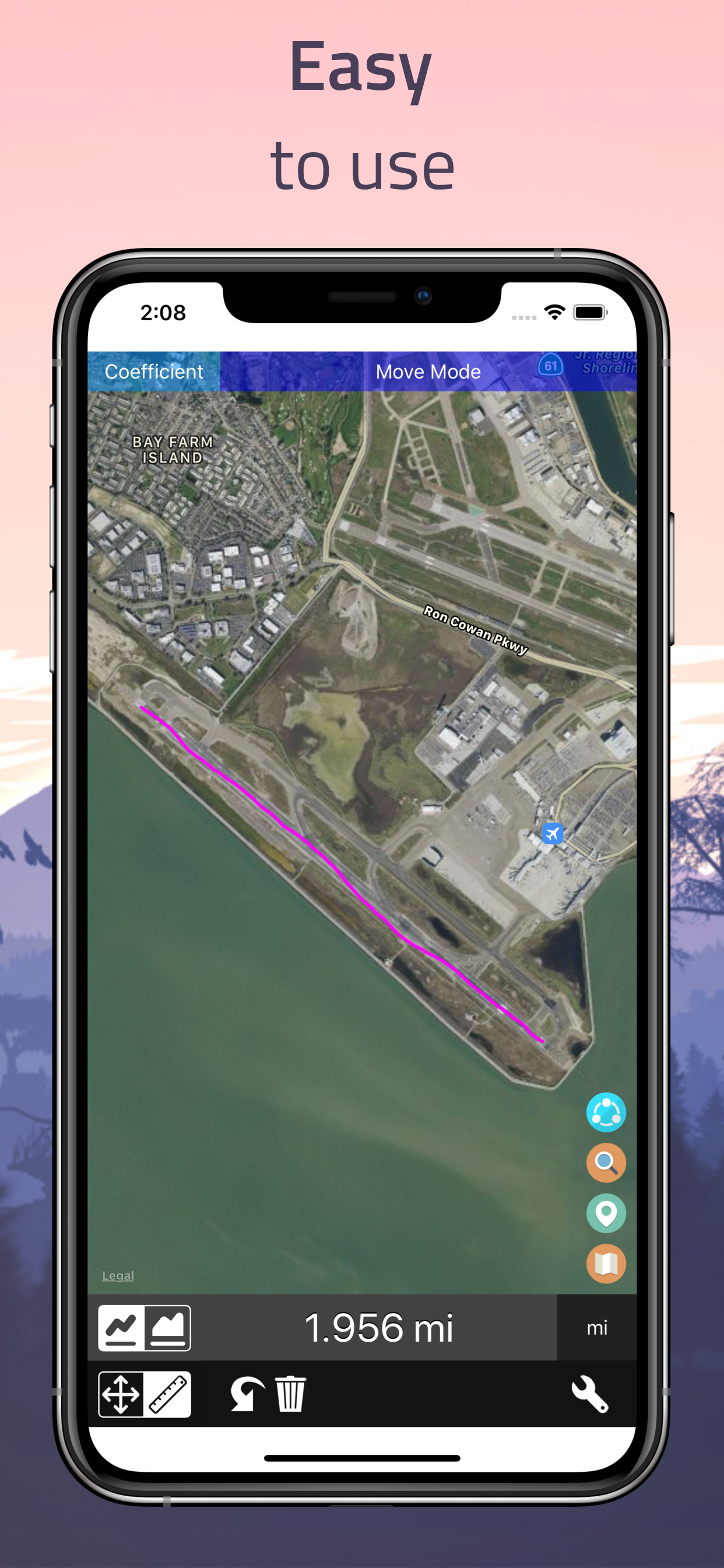
Measure distance and area by drawing directly on the map — simple, accurate, and powerful.
Drag to draw any path and instantly get the distance. Switch to area mode to outline and measure surfaces like fields, parks, or plots of land. A built-in magnifier helps you place points with precision.
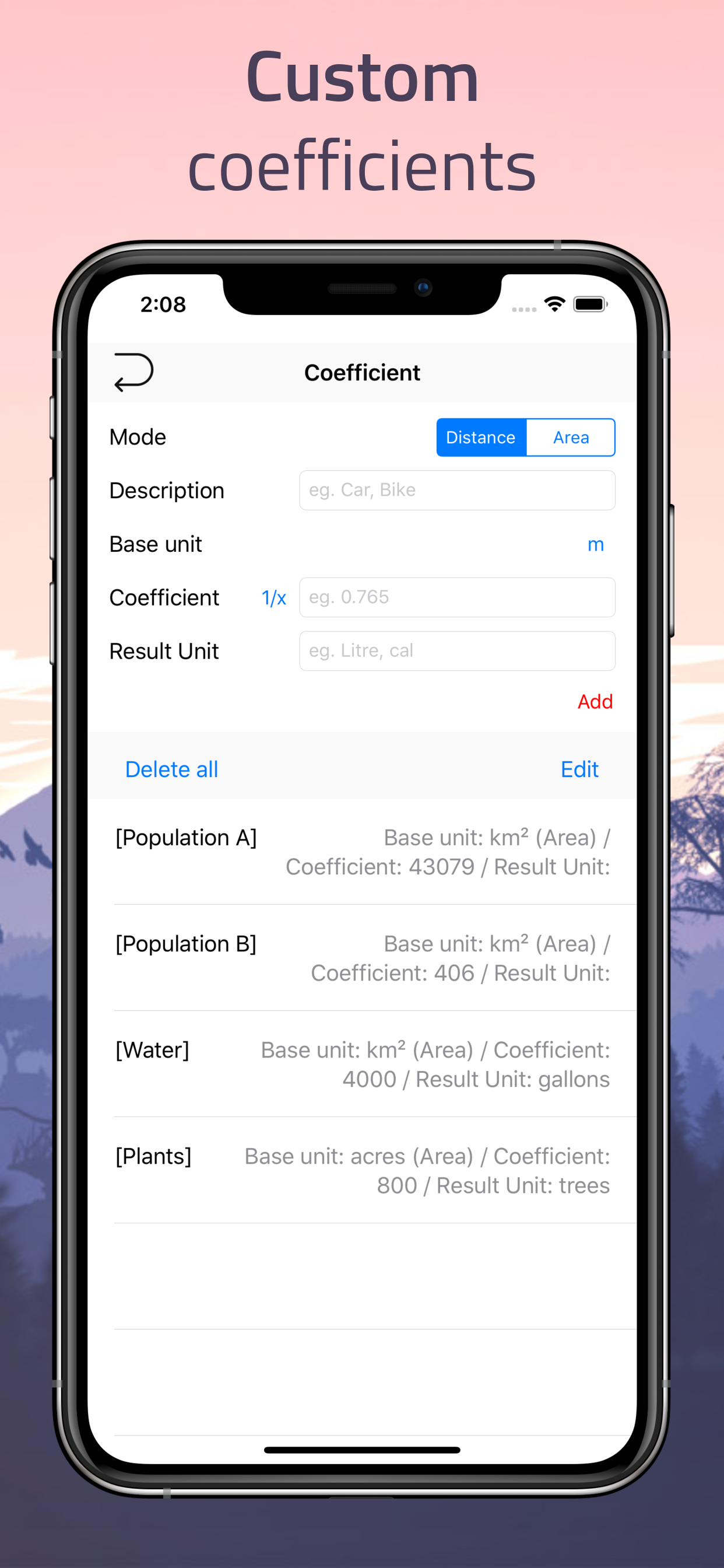
You can also apply a custom coefficient to estimate things like fuel usage, walking effort, or travel cost — perfect for trip planning, logistics, and real-world scenarios.
Ideal for hiking, biking, driving, surveying, and beyond.

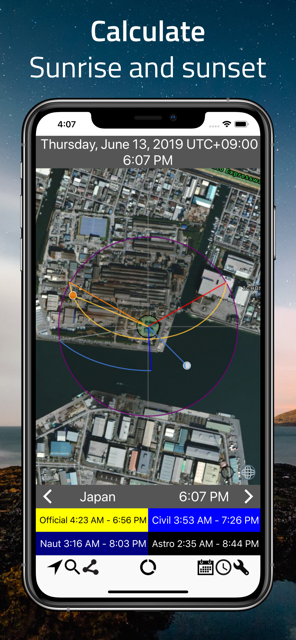
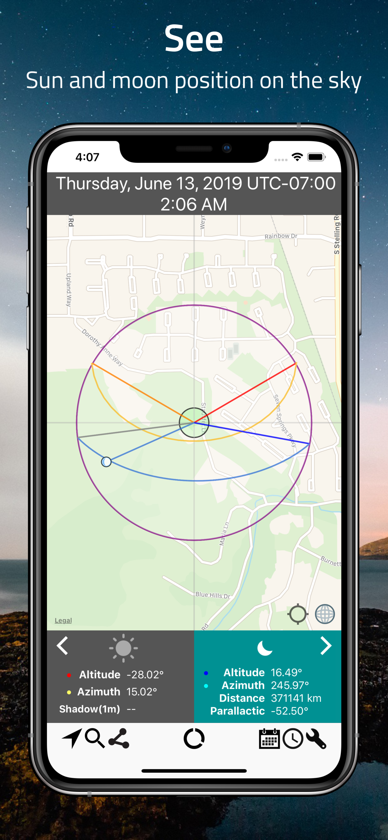

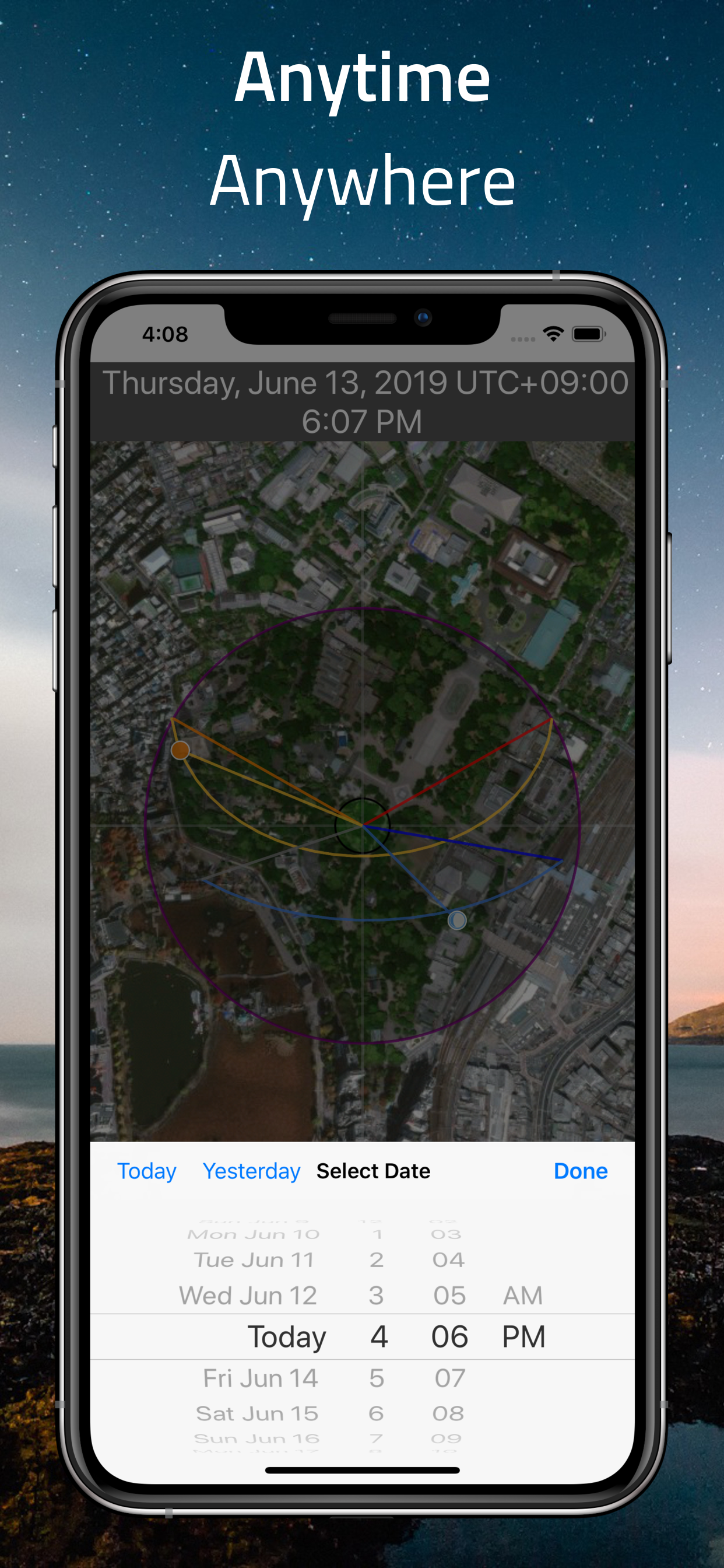

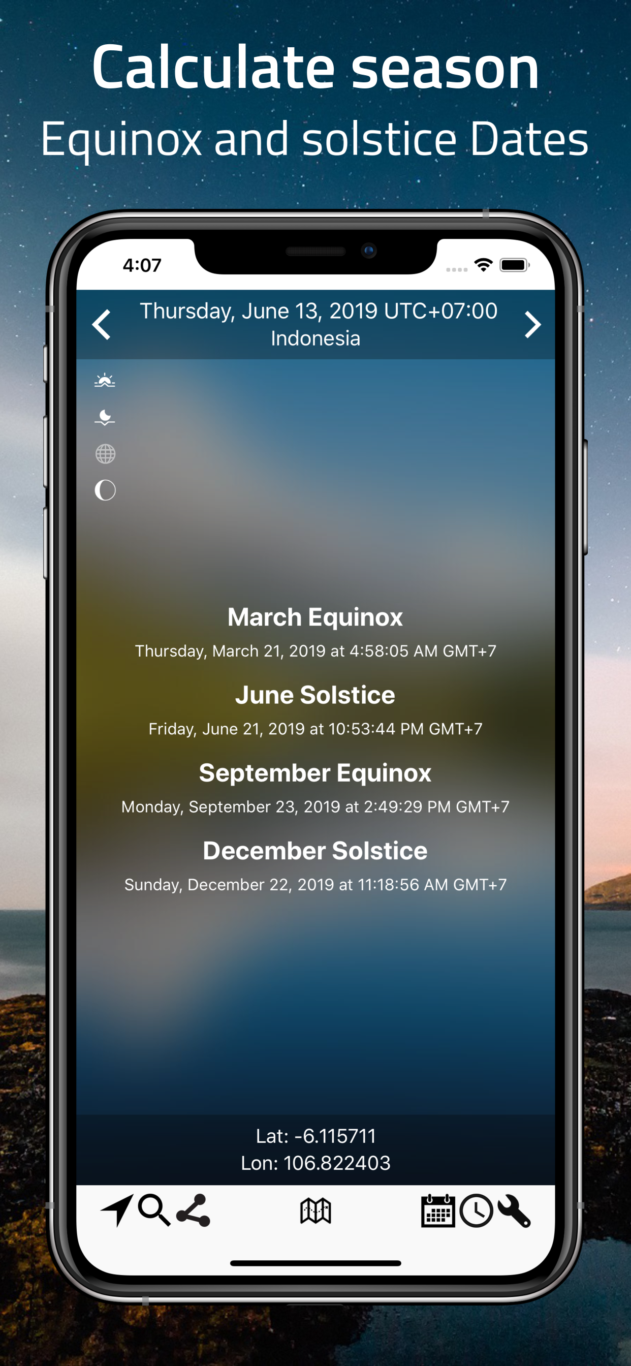

Luminos Map (formerly SunMap)
Plan your outdoor photography with precision — for free.
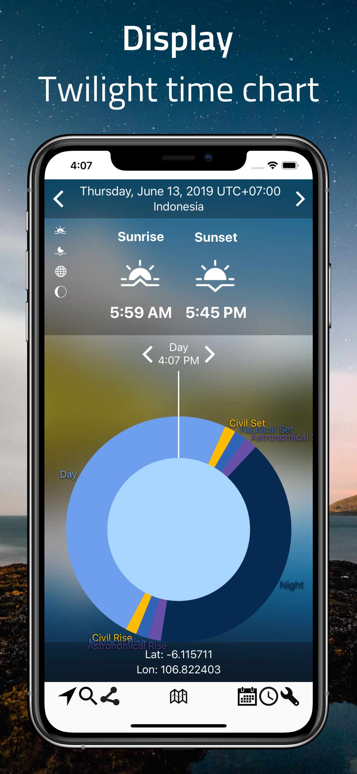
Curious about sunrise, sunset, moonrise, or moonset times? Luminos Map helps you visualize them clearly. See the exact position of the Sun and Moon, along with upcoming twilight phases, for any time and place in the world.
View it all in a beautiful time-chart or explore the interactive map filled with rich astronomical data. Pick any date and location to see how sunrise and sunset shift throughout the seasons.
Perfect for photographers, travelers, and night-sky watchers.


GeoLogger
A powerful GPS multi-tool for your phone or tablet.
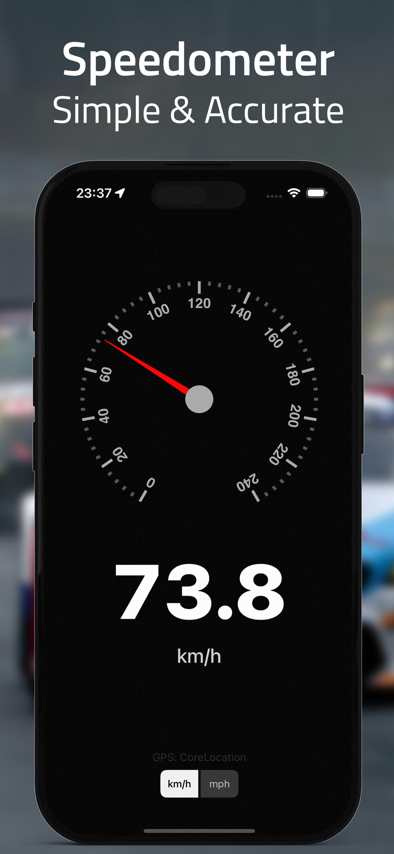
Speedometer & GPS Dashboard
View real-time GPS data including speed, elevation, direction (bearing), and coordinates — all in a sleek, head-up display. Whether you're riding, flying, sailing, cycling, or running, GeoLogger helps you monitor accurate speed and altitude.
Trip Recording & Tracking
Record your route with detailed data logs. Track your speed and elevation over time and view your journey as a line graph. You can edit trip details directly within the app using the built-in text editor, or export everything to a standard .gpx file for use in other tools.
Perfect for adventurers, pilots, athletes, and anyone who needs reliable GPS tracking.
Also available...

Addressfinder
Quick Address lookup on a map. Find full addresses, Zip code/Post code number

DIStancepinner
Find the distance between points on the map. Useful for route planning, traveling, and more.
Area & Distance
Measuring area and distance on the map has never been easier — this app makes it fast, simple, and accurate.

GeoLogger
Read, Record, and Track your trip. See GPS data such as, elevation, speed, direction of your current location.
and much more...