iOS 17

Hello,

iOS 17 is finally here. And all of our apps went through the update smoothly without issue. We just recently released a minor update for every single app just for it too.

With Q3 coming to an end, we need more time to work on the promised feature. We read many of the emails sent to our mailbox, We do notice some confusion on each app's capabilities. We will soon. release a better short explanation for every app on our website soon. So for Q4, our big plan is to do a website upgrade.

Also, we decided to not continue working on the Apple Watch yet as we don’t see much demand for it.


Thanks for reading and have a nice day!


Quarterly Update: Q2 2023

Hello again,

Despite not having many updates, we finished most of what we promised in the Q1 update.

  • We finished re-writing Elevation instructions for iOS in PDF format.

  • Slope feature for Elevation iOS app

What we will do next for Q3 2023

  • Due to many requests, we will implement a paid feature to DistanceCalculator and Geologger app.

  • Hopefully, we will be able to rework on Apple Watch version of all apps.

Unfortunately, we decided to shut down our AIPainter app due to operating costs.

Please email us for feature requests and suggestions so that we can do it asap.

Quarterly Update: Q1 2023

Hello, it's been a while since our last update. We have noticed the emerging technology of AI, especially ChatGPT, which we believe is a huge disruption to every sector. However, at the same time, there are a lot of opportunities possible from it. We will find a way to use this technology to improve our product pipeline in the future.

We have also created our first app with its first prototype design by ChatGPT called AIPainter.

Here is what we plan to do next within Q2:

  • We will focus our efforts on the Elevation app and add more features to its app.

  • We will complete the documentation rewrite for the Elevation app.

  • We plan to launch another AI-inspired app.

For our 2023 roadmap, we are hoping to launch a desktop version of certain apps. However, we will need to seriously think about its revenue model first to make it sustainable for us and provide the best experience for our users.

Thank you for reading.

Introducing our new app: AI Painter

Hello everyone,

I would like to share a story.

With the help of AI, I finally managed to write a new experimental app from scratch plus ten languages within two weeks.

Download link: https://linktr.ee/aipainter

Intro:

I had an idea of doing apps with AI but I have no idea how to start. Luckily, last year there was a tool called Stable Diffusion that utilized computing power from graphic cards to construct images generated by an AI.

This is ideal because our company has quite a size of GPU mining equipment laying around untouched due to a crash in cryptocurrency prices.

So here is the plan for the simple app:

Make a frontend app to connect to the Stable Diffusion server and make it easy to use as possible.


Let’s get started

  1. Write a working app

For this task, I use ChatGPT to construct a basic working code for my app. Unsurprisingly, it’s not working out of the box. But the most important thing I got from here is I finally managed to have some idea of how to start building the app.

It took less than a day for my first working prototype, which really encourage me to keep working on the app. It still takes another week for polishing though.


2. Create app icons

I used Stable Diffusion to suggest app icons. These are a few of them. I chose the first one and cropped it a little to make it stands out more

3. Working on UI

Unfortunately, AI didn’t have much help here so I still have to do it manually.

4. Building a server

I’m using my existing mining rig which runs on multiple RTX3080s, I had to upgrade RAM and CPU to make it respond faster. Still, I think it might probably be much more economical than renting GPU-enabled VPS.

5. Writing legal texts

This is where AI shines a lot. No explanation needed

6. Write store description

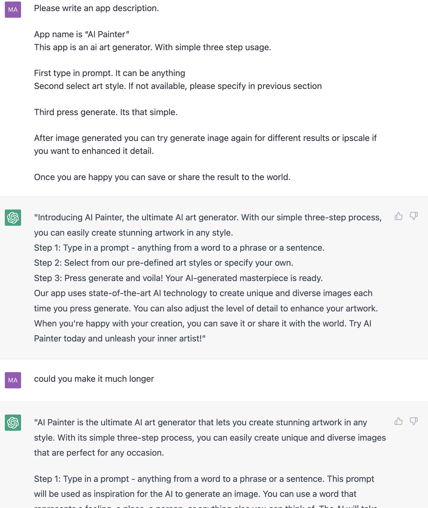
Instead of taking me hours of writing, now took me seconds.

7. Screenshot

Unfortunately, this is manual labor since I’m using Photoshop to design all screenshots for all ten languages.

8. Localization

Since I’m using Google Translate, so no AI works here.

If you want to try the app, here is the link.

https://linktr.ee/aipainter

Summary

Here is a list of tasks I wrote previously. Parts that AI was involved in are highlighted in bold.

  1. Write a working app - 50% Prototype only

  2. Create app icon - 100%

  3. Working on UI

  4. Building a server

  5. Write legal texts - 100%

  6. Write store descriptions - 100%

  7. Screenshots

  8. Localization

I think AI saved me more than a week of work.

Here is what I think how AI is useful for app production

  • Speed up development time, don’t need for extra labor for the repetitive task.

  • Anything to do with human language writing

  • Best for searching code snippets or writing basic functions. 80% of the time could replace a few search results on Google or stack overflow.


2023 is the year of AI, we need to adapt to prepare for any disruption.

Long overdue PDF documentation for Coordinates iOS app is now available for download

Happy New Year 2023!

I hope you all have had a great new year so far.

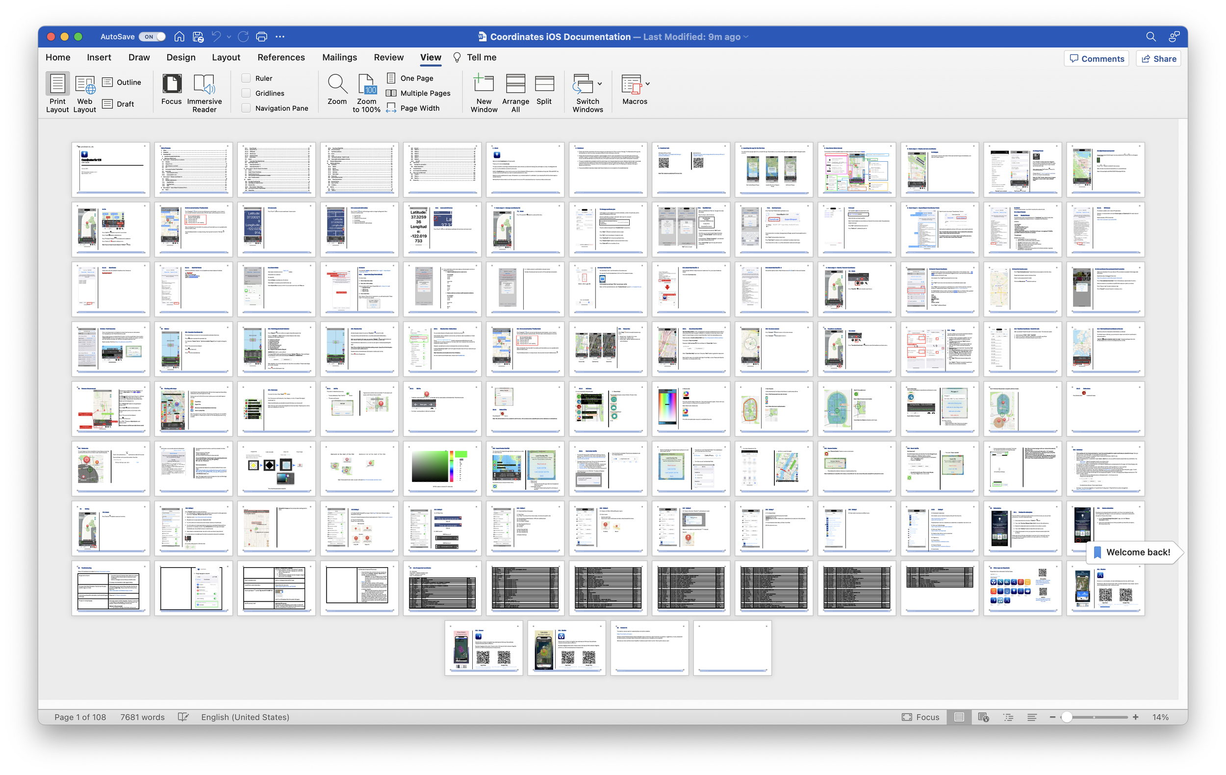
I’m here today to share some good news. Coordinates iOS app finally has PDF documentation which included all updates I posted in many blog posts, now all in one place.

The First version has 107 pages in total.

You can find the download link here - Coordinates Instruction

PDF Documentation for Android version will come later this month.

Have a great day!

2022 Summary

I just pushed the final 2022 updates to all apps just in time before Christmas. I expect those updates will be the last before the end of 2022.

So far here is what happened to our apps in 2022

  • We fix Blastsim and Elevation data source

  • We resurrected Android apps. Many missing Coordinates Android app features were added, and now at least 90% of an iOS counterpart.

  • Significant feature updates to Coordinates iOS version

  • Subscription for Coordinates Android


What’s next?

  • The Android version will soon have an in-app subscription just like the iOS version, hopefully, we will be able to launch the first app sometime during January 2023.

  • We said we would finish it during January 2023, but we managed to finish working on it much more early than expected! Please update the app to version 4.5.0 to see the menu!

  • We kept subscription pricing under the same USD values. Note that pricing may be a bit slightly different from the iOS version depending on the region due to Google and Apple having different Tax/Vat policies. Unfortunately, we have no control over that.


  • The coordinates app is always our flagship app. We will make it even better. We aim to add even more features to make it comparable to some professional applications available in the market. If you have any ideas, please do not hesitate to contact us.

We would like to take a moment to say thank you to all of our users who have used our apps. Your support and feedback have been invaluable to us, and we are grateful for the opportunity to serve you. In fact, many of the updates and improvements we have made to our apps are directly based on suggestions from users like you.

We encourage everyone to continue sending us your ideas and suggestions for how our apps can be improved. By working together, we can make our apps even better and more useful for everyone.

As we approach the end of the year, we would also like to wish you all a happy and prosperous 2023. We hope that the new year brings you joy, success, and many more opportunities to use and enjoy our apps.

Thank you again for your support, and we look forward to continuing to serve you in the new year.

Best wishes, Mapnitude Co., Ltd.

Coordinates iOS - Roadmap to 8.0.0 Working with polygon / Shape file / KML

This section is for preparing the iOS Coordinates app for a major version upgrade. New features will be introduced over time until version 8.0.0 is released.

Feature list

  • Import .kml file - Version 7.4.1

  • Export .kml file - Version 7.4.1

  • Add/Edit overlay pin - Version 7.4.2

  • Draw Overlay/Shape - Version 7.5.0

  • Distance/Area Measurement - Version 7.5.0

  • Custom Pin - Version 7.5.1

  • Open Street - Version Map 7.6.0

As this is currently an experimental feature. Please make sure you read this post entirely before proceed using. Always save the existing coordinates list before experimenting.

There are limitations and quirks behind this feature. And They are subject to change. It is highly recommended to come back to this post every time when there’s a new app update. Change logs will be posted right at the top for quick access.


Overlay Tools (7.5.1)+

Warning: Since version 7.5.3, the app will store overlays on the memory, but they are not included in the coordinates list. Please export to the .kml file manually to prevent losing progress.

From here you can add extra pins, lines, shapes, or circles. On top of the original coordinates list

Distance and Area data are provided alongside the shape you drew as well.

Note: These pins will not be saved alongside coordinates pin data. Please export to .kml to save these added pins for later use.

To access the menu. Press pencil button

Add Pin

  • To add pin. Press green button.

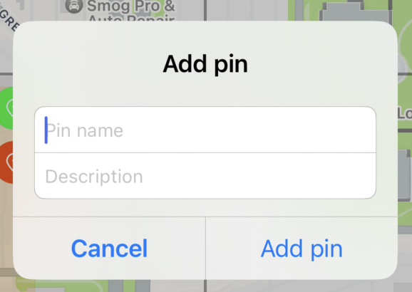
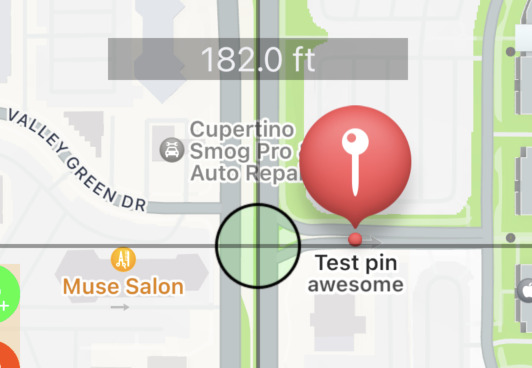
  • Type pin name and description as needed. The description will appear under the pin title as a subtitle.

Edit pin

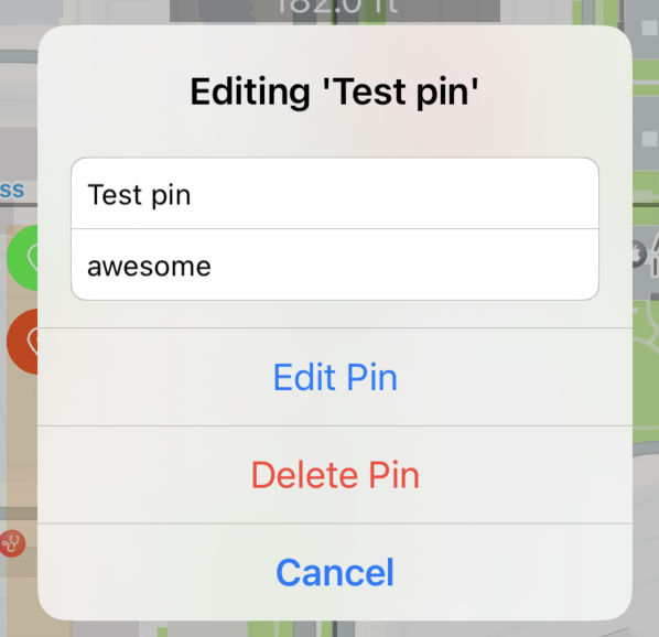
  • to edit pin, press at the pin on the map until pin name appear at the bottom bar

  • From here, you may edit pin, delete pin as desired

Delete all pin

  • Press delete all button

Note: This will only delete all pins created through this menu. All coordinates pins created through another method are not deleted here.

Add Shape

It is recommended to follow this step

  1. Choose Shape

Press to switch between options: Polyline, Polygon, Circle

Polyline (Line)

Polygon (Closed Shape)

Circle

2. Choose color

Press color wheel to begin choose color

Default color is black

Color updated to blue

3. Start drawing

In this tutorial we will try draw a closed shape on apple campus like so

Step 1: Pick Polygon and choose desired color

Step 2: Move the map to starting location

Step 3: Press add button

Step 4. Move the map to next location

Repeat step 3 and 4 until getting a full shape

Step 5: Close shape
Press close shape button or press the text at the bottom screen

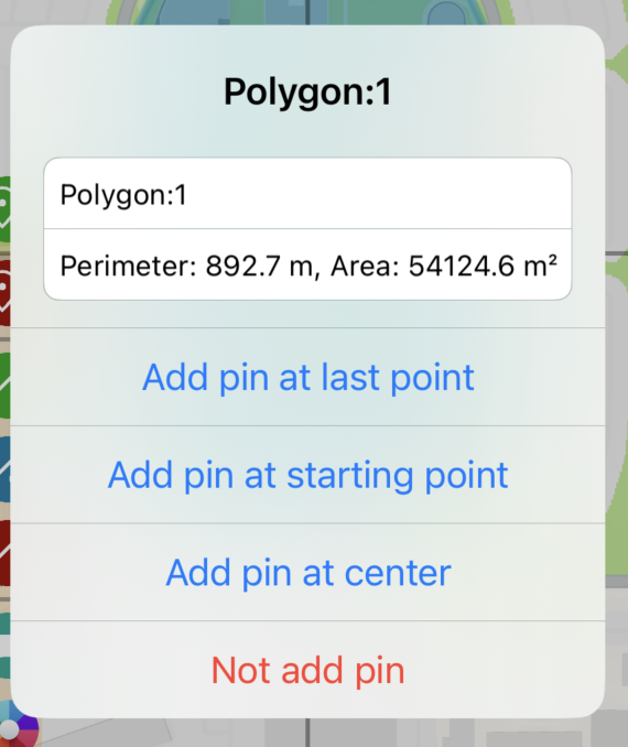
Step 6: Add pin if required

From here, you can

  • Edit pin name.

  • Read distance/perimeter. Read area calculation

  • Add or not to add pin at the desired position

Step 7: (Optional) Repeat step 1 onward to add more shapes.

Custom pins

You can change pins from a standard pin to any shape you want by specifying the prefix of the pin title to match specific keywords.

To edit. Go to setting by pressing wrench button at the bottom right of the screen

Then scroll down until you see this section. Press Edit.

From here you can edit pin information. Since this is still under construction, it will look a bit overwhelming.

An example script has three lines. each line is divided into three sections.

Here is a structure of the data

<prefix>,<colorcode>,<url>

Let’s look at the first line from the above example


diamond,ADD8E6,https://upload.wikimedia.org/wikipedia/commons/thumb/1/1c/MK_road_sign_306.svg/480px-MK_road_sign_306.svg.png


Here is an explanation.


Any pin which has ‘diamond’ as a prefix of a title will have an icon image https://upload.wikimedia.org/wikipedia/commons/thumb/1/1c/MK_road_sign_306.svg/480px-MK_road_sign_306.svg.png tinted in ADD8E6 (light-blue) color


Note: The image needs to have a transparency layer and the image will always be filled in a single color.

This is how the app process image file


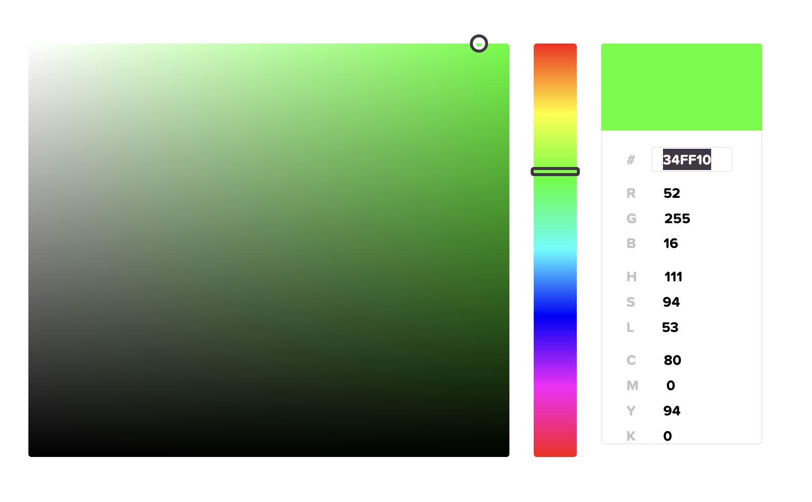
Note: To know which color code, you can try this site https://htmlcolorcodes.com/color-picker

34FF10 is what you have to fill in the script


KML Files (v7.4.0+)

Starting from version 7.4.0. We are introducing new features related to .kml files

You will be able to import/export .kml files and use it as overlay inside the app.

Read more about .kml file here https://en.wikipedia.org/wiki/Keyhole_Markup_Language

Import Overlay (.kml)

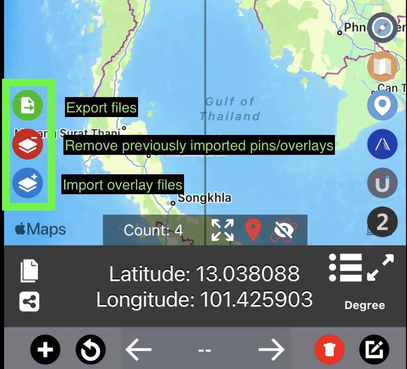
You may access this feature through the blue import button on the left side of the map.

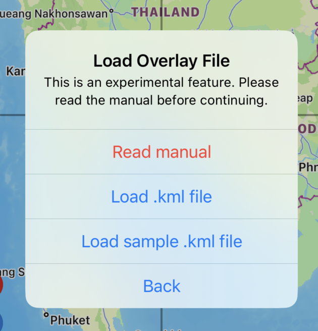
Press the blue button to launch import menu

  • Read manual

    • You are here now at this page :)

  • Load .kml file

    • Load .kml file from files app. Which will be explained in the next section

  • Load sample .kml file

    • The app will load sample overlay file and display on the map.


How to load .kml file

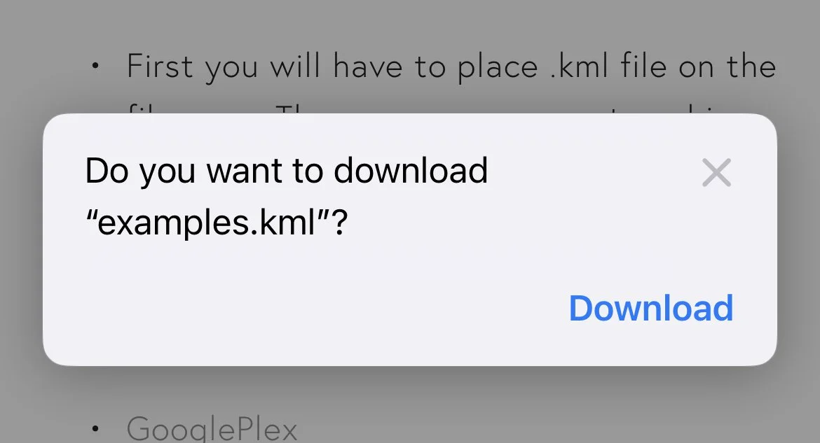
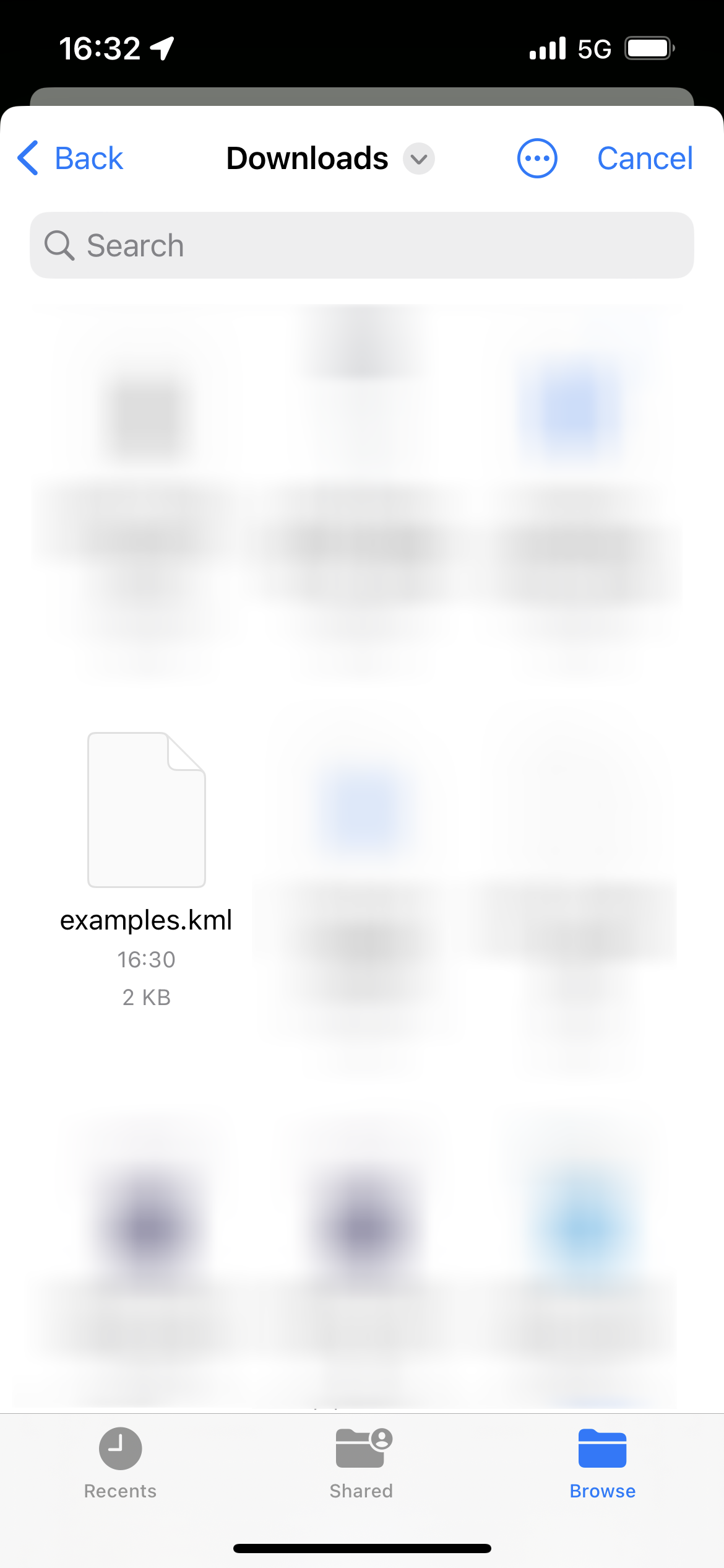
  • Once download is completed. Press blue arrow button to see list of downloaded files.

Back to Coordinates app. Go press import overlay button and press import .kml file

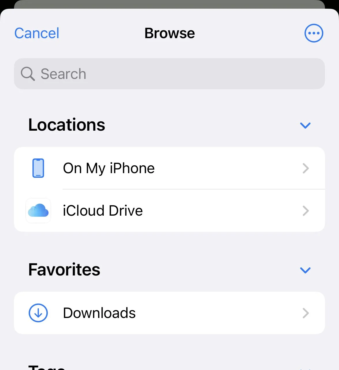
  • If you are not inside “Download” folder. Press back/browse until you go back to the top screen.

  • From here you will see download folder

  • From here Selected .kml file

  • Success!

Remove overlays

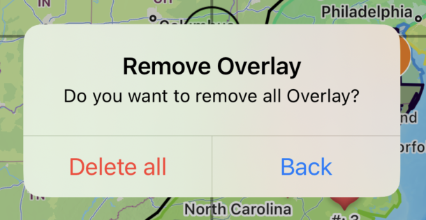
  • Press red button to open prompt screen

  • Press delete all to delete all previously imported overlays/pins

Note: Coordinates pins placed by other menus are not affected. You may remove those pins manually through another screen.

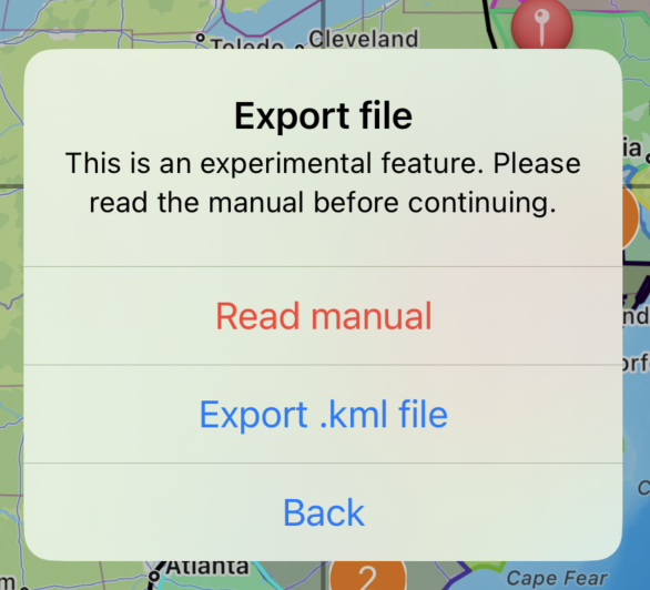
Export .kml file

Very important

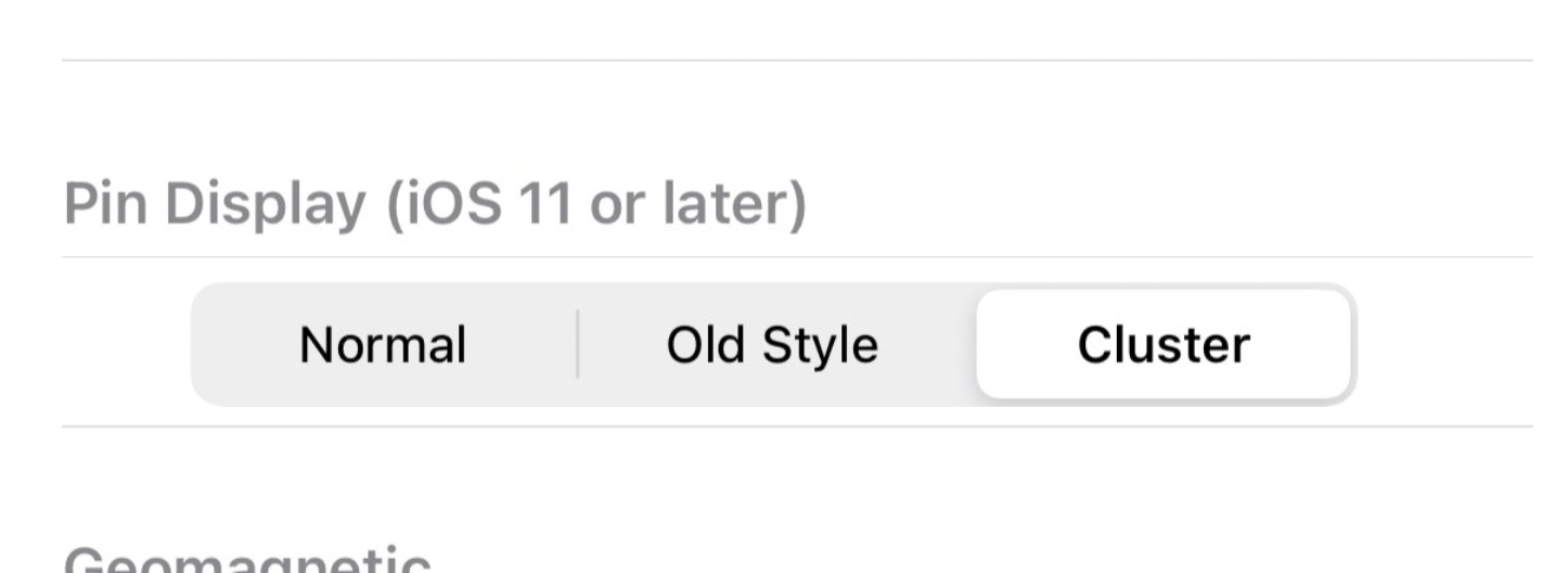
In order to export every pin correctly. You must change the pin display mode back to “Old Style” before continue

  • Go to the setting menu (Wrench button on the bottom right) -> Pin Display section

  • Change to “Old Style”

  • Completely close the app. Then re-open the app.

  • Then, press green button to proceed

  • Then select “Export .kml file”

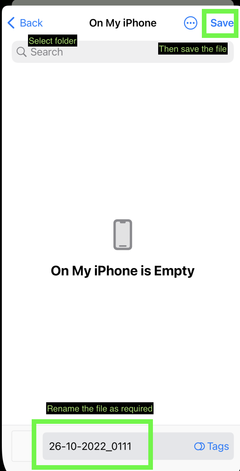
  • Choose saving destination as required. Then save.

  • You may later access the .kml though files app

Note: The color of each polygon will reset. Each will be randomly assigned a color.

Note2: All original placed coordinates points, .kml imported polygons, .kml imported polylines, .kml imported pins all will be combined and saved in the new .kml file.

Note3: If you are using the app with a device language other than supported by the coordinates app. "My location” pin may appear in the result. Please double-check and edit the file manually.

Things you need to know

  • These overlays will only display momentarily, it won’t be saved alongside the original coordinates pins placed in the app. Once you reset the app or close the screen. You will need to re-import them.

  • Currently, only vector .kml file is supported. Raster images will not display inside the app.

  • Icon images are not included in .kml file.

  • With some workarounds, it is possible to import .kmz or .shp files too, but you will first need to convert them to a .kml file first. You may do it here.

  • For .kmz file. It is possible to convert the file to .kml without 3rd party tool. Just decompress the file to get .kml file by changing .kmz file extension to .zip then unzip the file.

  • For .shp file do not forgot to upload also associated .dbf and .shx files (and if available also .prj and .cpg files)

  • If you can’t see the imported overlay. You may have to manually zoom in on the map to see overlays.

  • If your .kml file doesn’t work at all. You can try importing it to KMZ to KML converter and use that export file and try again. If it still doesn’t work. Please double-check check syntax of the files following the examples provided above.

  • Sometimes, pins that are imported through .kml files are grouped together. You can try changing the pin display mode back to “Old Style” for better visibility

    • Go to the setting menu (Wrench button on the bottom right) -> Pin Display section

    • Change to the desired mode

    • Completely close the app. Then re-open the app.


Open Street Map

Starting from version 7.6.0. You may switch the map from the original Apple Map to Open Street Map

Apple Map

Open Street Map

Go to Setting -> Change Map -> Choose between Apple Map or Open Street Map

Coordinates updates

First, I have to say sorry that the update on the Coordinates app may be a bit too frequent. Please enjoy it while I spend total energy to make the app as good as possible.

….

Anyway, let’s go back to the topic

I just added the feature that you are all waiting for (or not).

Searchable Coordinates format selector!

iOS Version

Android Version

This feature is surprisingly hard to implement. But I finally did it.

For now, I will stop releasing new updates on the Android version. So everyone can relax and not to have updated the app daily.

Starting next week I will continue working on the Coordinates iOS version. The new update will be BIG. I want it to be much more usable in professional work than being just a simple coordinates pinner app.

I hopefully plan to release it before December.

Lastly, many features added are actually from your suggestions! I would like to say thank you for the messages sent via email/contact form.

Updates to Android Version

Good evening.

As you might already know, there were ongoing big maintenance and updates for the Android version of our apps.

Coordinates

We added these missing features from an iOS version below

  • Fix issues with what3words format

  • The import/Export feature is now available with cross-platform compatibility between iOS and Android

  • Zoom in Zoom out button

  • 100s of new formats

  • Input your own custom Proj4 format

  • Move between pins on the map

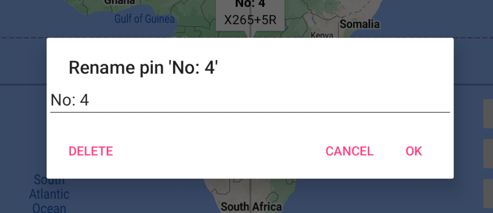
  • Press the center button (In this case “No:4) to rename or delete pin right on the main page

  • Zoom out to see all pins

  • Hide/Show all pins

  • Pin Count

Distance

  • New update after a year of inactivity

  • Bug fixes and update framework to the latest version

Elevation

  • Instead of bugfix. We rewrite the app from scratch for future compatibility

InspireMe

  • Ported from the iOS version

I also would like to apologize that the update may be a bit too frequent, I would like to ship the new feature as soon as possible without further delay. Feel free to report bugs if any.

Thanks for reading and have a nice day!