Elevation

Introducing Elevation 3.0

Hello,

I’m delighted to introduce you latest update to Elevation app.

Elevation 3.0

iPhone Xs Max-03Elevation - Lines_framed.png

There are changes in all three modes

  • Get Elevation

    • We switched to new server which is hosted by us. Improved performance expected

  • Get Elevation Range

    • Now it’s possible to measure elevation range in two or more sections

    • Lines color will reflect to height of that particular spot

    • Also switched to new server

  • Get Elevation from GPS

    • Now plot circles on the map and change color depends on elevation differences between points

    • Tap on a point to recall previous elevation value

Subscribe to remove ads will come soon.

Some good news

Hello everyone, I’m delighted to talk about new updates to our apps today.

Coordinates

VERSION 3.6!

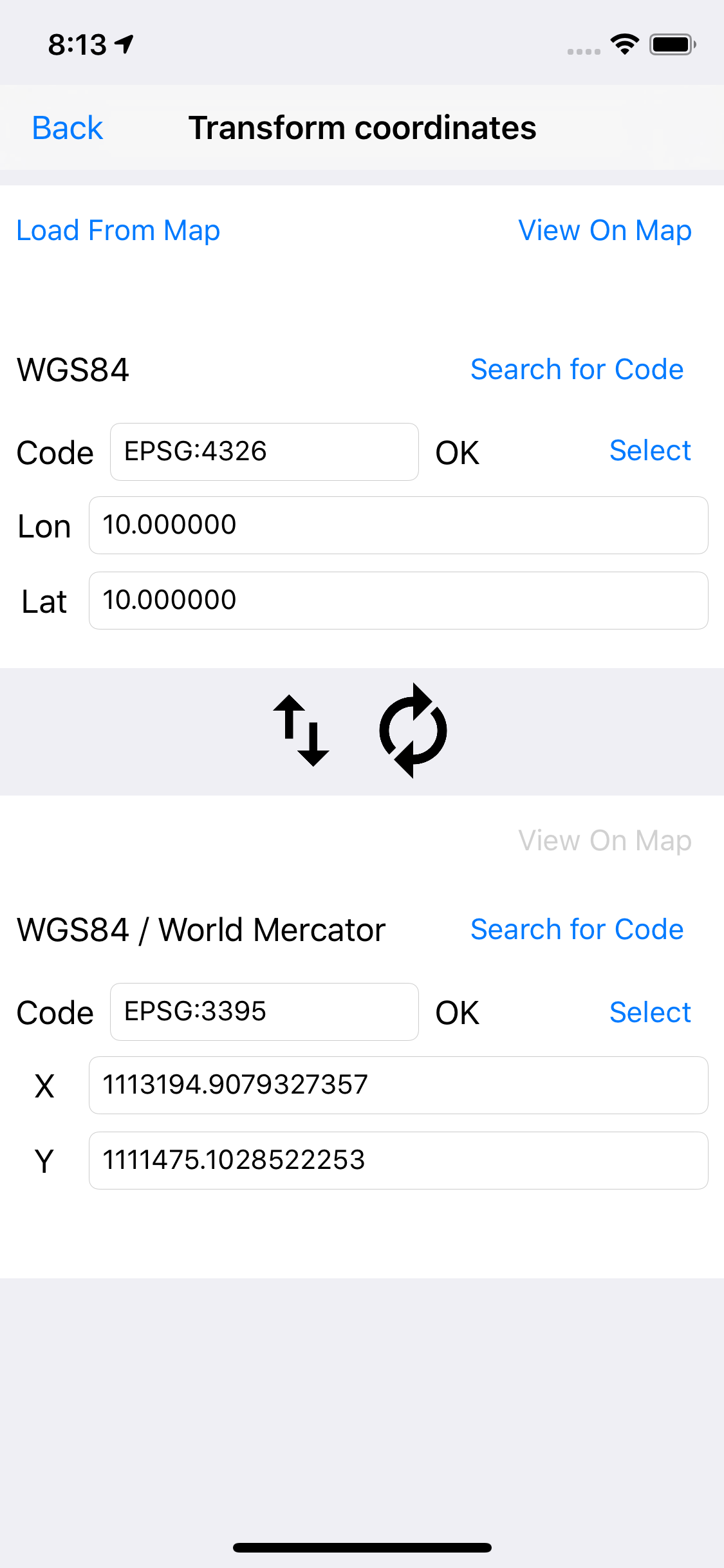
We added whole new section to this app: Coordinates convertor.

Now you can convert lat & long coordinates, geodetic datums and projected systems. Search online database for any system / datum.

Press EPSG button to access this page

 
Sorry for bad UI. We will update this soon once we received more feedback

Sorry for bad UI. We will update this soon once we received more feedback


Search spartal reference list online

Search spartal reference list online


If search result is not available. Note that you can put your own custom system. Make sure it’s in proj4 format. for example:

+proj=lcc +lat_1=42.6833319 +lat_2=41.71666666666667 +lat_0=41 +lon_0=-71.5 +x_0=200000 +y_0=750000 +ellps=GRS80 +units=m +no_defs

put this line in code textbox and it will works just fine.


Area

now we have new name for this app

Area & Distance - Map Measure

Yes. It’s now possible to measure distance within this app. We decided to merge DistancePinner into this one app.

area2.png
 
Area and Distance in one app

Area and Distance in one app


The best thing with this update is that you no longer need to place center pin before start measuring! Any complex shape will works now as long as there’s no overlapping line!


Elevation

elev2.png

The app is back up and running as normal. However, we need to add timer between each data access or we can’t provide the best app experience to everyone.


Blastsim

blastsim2.png

We added bunch of new localization. We still need more downloads to match our past BlastSim app.


We admit we releases new version very often during the past week. Sorry for inconvenience . In the meantime we will update documentation on this website to reflect new feature of our apps.

Again, feel free to contact us for any suggestion, or just talk to us! and we are sorry that we are unable to answer them all during last year.

That’s all about it. See you again next time!

Ps. Anyway, I’m still curious that is anyone is reading this blog. If you want to show that you came pass this, please write “ Katamari “ on the subject section and send me a message lol.
Not required. Just for fun :)